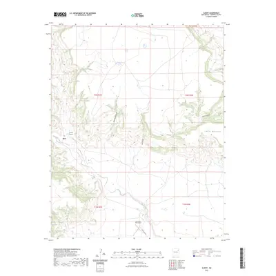
2023 Map of Albert
USGS Topo · Published 2023About this map
Albert sits at the junction of Tequesquite Creek and Carrizo Creek in this high-plains landscape of northeastern New Mexico. The geography is defined by a network of drainage systems cutting through the mesa lands, most notably the deep incisions of Carrizo Canyon, Plum Rincon Canyon, and Lalo Canyon. These watercourses converge near the settlement, suggesting a historical reliance on these rare perennial or seasonal water sources for ranching and transport. To the south, the Tequesquite Ranch Airport and Tequesquite Rd highlight the modernization of this rural area, while Revuel Springs and the expansive Mesa Quitaras to the east illustrate the enduring natural landmarks that have governed movement through this terrain for generations. The map provides a look at the contemporary township and range system, showing the section lines that still organize this ranching country.
Find a feature on this map
16 named features on this map. Tap any name to fly to it.
Don’t see what you’re looking for? This feature index may not catch every label — zoom into the map to look around manually.
Map Details
Editions of this 2023 Albert Map
This is the sole edition of this map. No revisions or reprints were ever made.
Other maps of this area

1954 · Tucumcari
USGS Topo · 1:250,000

1954 · Dalhart
USGS Topo · 1:250,000

1958 · Tucumcari
USGS Topo · 1:250,000

1958 · Dalhart
USGS Topo · 1:250,000

1962 · Dalhart
USGS Topo · 1:250,000

1973 · Circle Bar Ranch
USGS Topo · 1:24,000

1973 · Yates SE
USGS Topo · 1:24,000

1973 · Mosquero
USGS Topo · 1:24,000

1973 · Sabino
USGS Topo · 1:24,000
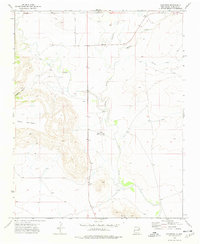
1973 · Bueyeros
USGS Topo · 1:24,000