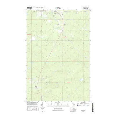
2017 Map of Alberta
USGS Topo · Published 2017About this map
L'Anse and the company town of Alberta anchor this landscape in the Upper Peninsula, where the rugged descent toward the Keweenaw Bay is marked by a series of dramatic river drops. The Falls River and its tributaries create a cascading geography including Power House Falls, Daults Falls, and Middle Falls. This water network historically powered the local timber industry, a legacy still visible in the layout of Alberta, which was famously established by Henry Ford as a sawmill town and model community.
Find a feature on this map
57 named features on this map. Tap any name to fly to it.
Don’t see what you’re looking for? This feature index may not catch every label — zoom into the map to look around manually.
Map Details
Editions of this 2017 Alberta Map
This is the sole edition of this map. No revisions or reprints were ever made.
Other maps of this area

1954 · Keweenaw Bay
USGS Topo · 1:62,500

1954 · Pelkie
USGS Topo · 1:62,500

1954 · Sidnaw
USGS Topo · 1:62,500

1955 · Herman
USGS Topo · 1:62,500

1958 · Iron River
USGS Topo · 1:250,000

1960 · Iron River
USGS Topo · 1:250,000

1961 · Iron River
USGS Topo · 1:250,000

1967 · Iron River
USGS Topo · 1:250,000
1984 · Aura
USGS Topo · 1:24,000
1985 · L'Anse
USGS Topo · 1:24,000