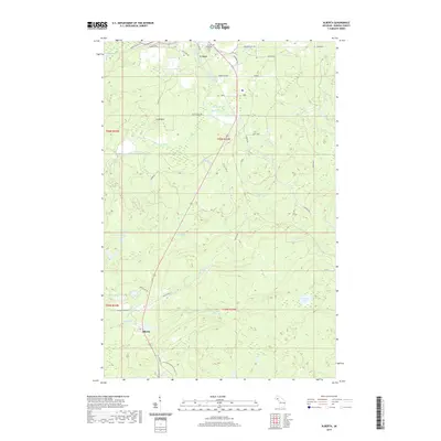
2019 Map of Alberta
USGS Topo · Published 2019About this map
Alberta stands as a focal point in this Baraga County survey, situated south of the larger village of L'Anse. This landscape is defined by the complex hydrology of the Falls River and its numerous cascades, including Middle Falls, River Falls, and Power Dam Falls. The settlement patterns here reflect a mix of early 20th-century civic infrastructure and industrial heritage, with the Poor Farm located near Herman RD and the L'Anse Township Cem serving the local population. To the south, the terrain rises toward Little Mtn, while the N Country National Scenic Trail winds through the forested highlands. Water features are abundant, from the isolated Kontio Lake in the east to Jackson Lakes and Plumbago Falls in the west, illustrating the timber-and-water resource base that long sustained these Upper Peninsula communities.
Find a feature on this map
54 named features on this map. Tap any name to fly to it.
Don’t see what you’re looking for? This feature index may not catch every label — zoom into the map to look around manually.
Map Details
Editions of this 2019 Alberta Map
This is the sole edition of this map. No revisions or reprints were ever made.
Other maps of this area

1954 · Keweenaw Bay
USGS Topo · 1:62,500

1954 · Pelkie
USGS Topo · 1:62,500

1954 · Sidnaw
USGS Topo · 1:62,500

1955 · Herman
USGS Topo · 1:62,500

1958 · Iron River
USGS Topo · 1:250,000

1960 · Iron River
USGS Topo · 1:250,000

1961 · Iron River
USGS Topo · 1:250,000

1967 · Iron River
USGS Topo · 1:250,000
1984 · Aura
USGS Topo · 1:24,000
1985 · L'Anse
USGS Topo · 1:24,000