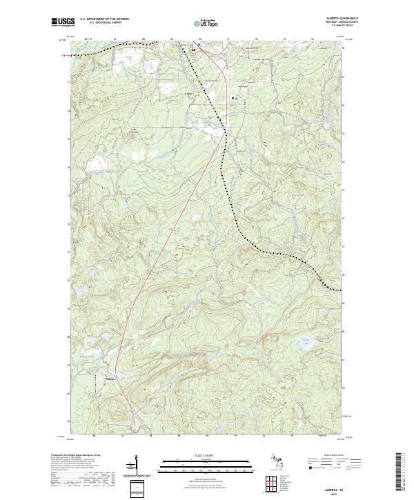
2023 Map of Alberta
USGS Topo · Published 2023About this map
The Falls River and its numerous cascades, including Middle Falls River Falls, Power House Falls, and Power Dam Falls, define the drainage of this Baraga County landscape. The map centers on the transition from the shores of L'Anse Bay to the inland woods of the Upper Peninsula, where small named settlements like Maki, Mead, and Usimaki dot the terrain. To the south, the community of Alberta stands near the headwaters of Plumbago Creek, while the north is anchored by the L'Anse Township Cem. Genealogists and historians can trace the network of old logging and local roads, such as Old US Hwy 41 and Old Dump Rd, as they wind past landmarks like Little Mountain and the Jackson Lakes. This record captures a region where water power and timber resources shaped the local geography and settlement patterns.
Find a feature on this map
53 named features on this map. Tap any name to fly to it.
Don’t see what you’re looking for? This feature index may not catch every label — zoom into the map to look around manually.
Map Details
Editions of this 2023 Alberta Map
This is the sole edition of this map. No revisions or reprints were ever made.
Other maps of this area

1954 · Keweenaw Bay
USGS Topo · 1:62,500

1954 · Pelkie
USGS Topo · 1:62,500

1954 · Sidnaw
USGS Topo · 1:62,500

1955 · Herman
USGS Topo · 1:62,500

1958 · Iron River
USGS Topo · 1:250,000

1960 · Iron River
USGS Topo · 1:250,000

1961 · Iron River
USGS Topo · 1:250,000

1967 · Iron River
USGS Topo · 1:250,000
1984 · Aura
USGS Topo · 1:24,000
1985 · L'Anse
USGS Topo · 1:24,000