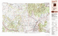
1983 Map of Albuquerque
USGS Topo · Published 1984About this map
Albuquerque and the Rio Grande valley dominate this early 1980s landscape, illustrating the suburban expansion into Rio Rancho, Paradise Hills, and Corrales. The map details a complex intersection of ancient cultural sites and modern infrastructure, where numerous sovereign lands including Jemez Pueblo, Zia Pueblo, and Santa Ana Pueblo sit adjacent to federal holdings like Kirtland Air Force Base and the Scientific Laboratory. The regional transport network is anchored by the Atchison Topeka and Santa Fe RR and Interstate 40, which roughly follows the path of the famous U.S. 66.
Find a feature on this map
94 named features on this map. Tap any name to fly to it.
Don’t see what you’re looking for? This feature index may not catch every label — zoom into the map to look around manually.
Map Details
Editions of this 1983 Albuquerque Map
This is the sole edition of this map. No revisions or reprints were ever made.
Other maps of this area

1883 · Mt. Taylor
USGS Topo · 1:250,000

1886 · Wingate
USGS Topo · 1:250,000

1886 · Mt. Taylor
USGS Topo · 1:250,000

1888 · Bernalillo
USGS Topo · 1:125,000

1889 · Albuquerque
USGS Topo · 1:125,000

1889 · Largo
USGS Topo · 1:250,000

1889 · Chaco
USGS Topo · 1:250,000

1889 · Santa Fe
USGS Topo · 1:125,000

1890 · Jemes
USGS Topo · 1:125,000

1892 · San Pedro
USGS Topo · 1:125,000