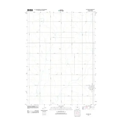
2012 Map of Alcester
USGS Topo · Published 2012About this map
W Brule Creek and E Brule Creek define the agricultural grid of Union County in the early 2010s. This survey centers on the quiet rural landscape between the forks of the Brule, where section lines are strictly maintained by a network of gravel and paved roads like 475th Ave and 300th St. The small settlement of Alcester appears in the southeastern corner, showing a concentrated street plan including Dakota St and Iowa St near the local Post Office. Away from the town center, Gothland Cemetery sits as a solitary landmark in the open countryside, providing a specific point of interest for genealogists tracing family roots in this corner of South Dakota.
Find a feature on this map
25 named features on this map. Tap any name to fly to it.
Don’t see what you’re looking for? This feature index may not catch every label — zoom into the map to look around manually.
Map Details
Editions of this 2012 Alcester Map
This is the sole edition of this map. No revisions or reprints were ever made.
Other maps of this area

1897 · Canton
USGS Topo · 1:125,000

1898 · Elk Point
USGS Topo · 1:125,000

1900 · Canton
USGS Topo · 1:125,000

1901 · Elk Point
USGS Topo · 1:125,000

1907 · Elk Point
USGS Topo · 1:125,000

1955 · Sioux City
USGS Topo · 1:250,000

1955 · Sioux Falls
USGS Topo · 1:250,000

1958 · Sioux City
USGS Topo · 1:250,000

1958 · Sioux Falls
USGS Topo · 1:250,000

1959 · Sioux City
USGS Topo · 1:250,000