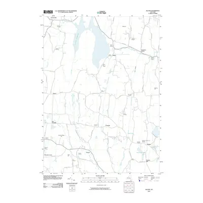
2010 Map of Alcove
USGS Topo · Published 2010About this map
Alcove Reservoir dominates the landscape of this Greene and Albany County border region, serving as a focal point for the surrounding hamlets. The terrain is characterized by a high density of rural burial grounds, including the Indian Fields Cemetery, Coeymans Hollow Cemetery, and the Medway Congregational Christian Cemetery, which offer significant genealogical value for researchers of the area's established families. Small settlements like Dormansville, Grapeville, and Surprise are connected by a network of local routes such as Co Rd 111 and Feather Bed Ln.
Find a feature on this map
95 named features on this map. Tap any name to fly to it.
Don’t see what you’re looking for? This feature index may not catch every label — zoom into the map to look around manually.
Map Details
Editions of this 2010 Alcove Map
This is the sole edition of this map. No revisions or reprints were ever made.
Other maps of this area

1893 · Coxsackie
USGS Topo · 1:62,500

1893 · Durham
USGS Topo · 1:62,500

1893 · Albany
USGS Topo · 1:62,500

1894 · Coxsackie
USGS Topo · 1:62,500

1894 · Durham
USGS Topo · 1:62,500

1895 · Albany
USGS Topo · 1:62,500

1898 · Albany
USGS Topo · 1:62,500

1900 · Berne
USGS Topo · 1:62,500

1903 · Berne
USGS Topo · 1:62,500

1927 · Albany
USGS Topo · 1:62,500