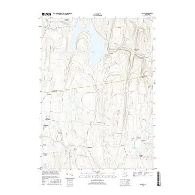
2016 Map of Alcove
USGS Topo · Published 2016About this map
Alcove Reservoir dominates the northern landscape of this region where Albany Co and Greene Co meet. The area is defined by its deep history of rural settlement, centered around villages like Alcove, Grapeville, and Coeymans Hollow. The terrain is marked by significant elevations such as the Helderberg Mountains and Murder Bridge Hill, with water drainage flowing through Hannacrois Creek and Grapeville Cr. For family historians, the map is remarkably dense with burial sites, including the Medway Congregational Christian Cem, Sylvanadale Cem, and King Hill Cem. Small water bodies like Silver Lake and Beaver Dam Lake dot the southern half, while Dickinson Falls provides a specific landmark along the creek systems that historically powered the local economy.
Find a feature on this map
102 named features on this map. Tap any name to fly to it.
Don’t see what you’re looking for? This feature index may not catch every label — zoom into the map to look around manually.
Map Details
Editions of this 2016 Alcove Map
This is the sole edition of this map. No revisions or reprints were ever made.
Other maps of this area

1893 · Coxsackie
USGS Topo · 1:62,500

1893 · Durham
USGS Topo · 1:62,500

1893 · Albany
USGS Topo · 1:62,500

1894 · Coxsackie
USGS Topo · 1:62,500

1894 · Durham
USGS Topo · 1:62,500

1895 · Albany
USGS Topo · 1:62,500

1898 · Albany
USGS Topo · 1:62,500

1900 · Berne
USGS Topo · 1:62,500

1903 · Berne
USGS Topo · 1:62,500

1927 · Albany
USGS Topo · 1:62,500