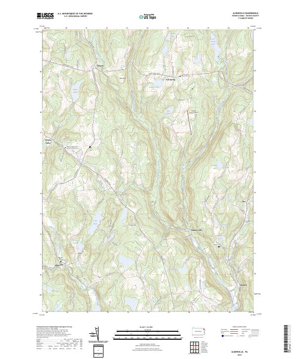
2023 Map of Aldenville
USGS Topo · Published 2023About this map
Tanners Falls and Aldenville serve as focal points for this portion of Wayne County, where the landscape is defined by the complex drainage systems of the West Branch Lackawaxen River and multiple branches of the Dyberry Creek. The 2023 survey illustrates a region where historic transportation routes like the Great Bend Tpke and Bethany Tpke still influence the local road network. Genealogists will find significant value in the detailed plotting of local burial grounds, including the Saint Cecilia's Roman Catholic Church Cem and Wheatcraft Cem. The area is characterized by numerous small lakes and ponds, such as Miller Pond and Lake Cayuga, interspersed with scattered settlements like Niagara and Cold Spring. The presence of the Charles G Kalko Airport near Carr Pond indicates the continued utility of the plateau terrain for local aviation.
Find a feature on this map
75 named features on this map. Tap any name to fly to it.
Don’t see what you’re looking for? This feature index may not catch every label — zoom into the map to look around manually.
Map Details
Editions of this 2023 Aldenville Map
This is the sole edition of this map. No revisions or reprints were ever made.
Other maps of this area

1892 · Honesdale
USGS Topo · 1:62,500

1920 · Long Eddy
USGS Topo · 1:62,500

1920 · Damascus
USGS Topo · 1:62,500

1921 · Long Eddy
USGS Topo · 1:48,000

1923 · Damascus
USGS Topo · 1:62,500

1923 · Long Eddy
USGS Topo · 1:62,500

1926 · Starrucca
USGS Topo · 1:62,500

1930 · Starrucca
USGS Topo · 1:48,000

1933 · Starrucca
USGS Topo · 1:62,500

1943 · Honesdale
USGS Topo · 1:125,000
Featured Places
- Dyberry Township, PA
- Oregon Township, PA
- Mount Pleasant Township, PA
- Lebanon Township, PA
- Clinton Township, PA