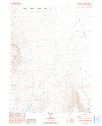
1990 Map of Alder Creek Ranch
USGS Topo · Published 1990About this map
Mc Gee Mountain dominates the western topography of this 1990 survey, overlooking a landscape defined by isolated ranching outposts and mineral exploration in Humboldt County. To the north, the Sheldon National Wildlife Refuge marks a significant conservation boundary, while the arid flats of Bog Hot Valley stretch across the northeast. The presence of the Painted Hills Mine and various prospects suggest the region's long-standing connection to small-scale mining. Water sources are critical here, evidenced by the clustered wells, stock ponds, and named features like Warm Springs and Gridley Lake. Local history is centered around the eponymous Alder Creek Ranch and the settlement at 3 Springs, illustrating the enduring nature of Great Basin high-desert life. The detailed mapping of drainage systems like Craine Creek and Alder Creek provides a clear view of the area's watershed before it reaches the valley floor.
Find a feature on this map
23 named features on this map. Tap any name to fly to it.
Don’t see what you’re looking for? This feature index may not catch every label — zoom into the map to look around manually.
Map Details
Editions of this 1990 Alder Creek Ranch Map
This is the sole edition of this map. No revisions or reprints were ever made.
Other maps of this area

1886 · Disaster
USGS Topo · 1:250,000

1893 · Disaster
USGS Topo · 1:250,000

1954 · Vya
USGS Topo · 1:250,000

1958 · Vya
USGS Topo · 1:250,000

1962 · Vya
USGS Topo · 1:250,000

1965 · Railroad Point
USGS Topo · 1:62,500

1965 · Idaho Canyon
USGS Topo · 1:62,500

1965 · Duffer Peak
USGS Topo · 1:62,500

1966 · Denio
USGS Topo · 1:62,500

1979 · Denio
USGS Topo · 1:100,000