
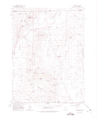
1966 Map of Denio
USGS Topo · Published 1968About this map
Pueblo Mountains and the Pine Forest Range dominate this mid-century survey of the high desert borderlands. The settlement of Denio sits just south of the Oregon Nevada line, serving as a hub near the Alkali Flat and Pueblo Valley. The landscape is a study in survival and industry, marked by remote outposts like Wilder Creek Ranch and Harness Ranch, alongside several mining operations such as the Ashdown Mine and Hall Mine.
Find a feature on this map
76 named features on this map. Tap any name to fly to it.
Don’t see what you’re looking for? This feature index may not catch every label — zoom into the map to look around manually.
Map Details
Editions of this 1966 Denio Map
2 editions found
Other maps of this area

1886 · Disaster
USGS Topo · 1:250,000

1893 · Disaster
USGS Topo · 1:250,000

1954 · Vya
USGS Topo · 1:250,000

1955 · Adel
USGS Topo · 1:250,000

1957 · Adel
USGS Topo · 1:250,000

1958 · Vya
USGS Topo · 1:250,000

1958 · Adel
USGS Topo · 1:250,000

1961 · Quinn River Crossing
USGS Topo · 1:62,500

1961 · Trident Peak
USGS Topo · 1:62,500

1962 · Vya
USGS Topo · 1:250,000