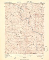
1951 Map of Alderpoint
USGS Topo · Published 1951About this map
The Northwestern Pacific River corridor defines this 1951 study of the remote Eel River canyon, where the rails snake alongside the Eel River through a landscape dominated by timber and ranching. Small settlements like Alderpoint and Fort Seward serve as the primary hubs for the region's isolated homesteads, including Ware Ranch and Stockton Ranch. The influence of the timber industry is evident at the Lumber Mill located along Rays Creek in the southern portion of the quadrangle.
Find a feature on this map
66 named features on this map. Tap any name to fly to it.
Don’t see what you’re looking for? This feature index may not catch every label — zoom into the map to look around manually.
Map Details
Editions of this 1951 Alderpoint Map
2 editions found

Other maps of this area

1918 · Anada
USGS Topo · 1:62,500

1920 · Cummings
USGS Topo · 1:62,500

1920 · Covelo
USGS Topo · 1:62,500

1920 · Harris
USGS Topo · 1:62,500

1921 · Dyerville
USGS Topo · 1:62,500

1921 · Briceland
USGS Topo · 1:62,500

1921 · Hoaglin
USGS Topo · 1:62,500

1922 · Island Mountain
USGS Topo · 1:62,500

1931 · Hoaglin
USGS Topo · 1:96,000

1935 · Hoaglin
USGS Topo · 1:125,000