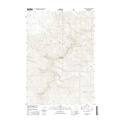
2015 Map of Aldrich Basin
USGS Topo · Published 2015About this map
Aldrich Basin and the surrounding high-altitude terrain of the Shoshone National Forest characterize this part of Park County. The map details a complex drainage system within the Absaroka Range, where numerous seasonal and perennial streams like Aldrich Cr and W Fork Rock Cr carve through the landscape. The massive shoulder of Carter Mtn dominates the central portion of the survey, rising above the basin floor and providing a natural barrier between the different creek drainages.
Find a feature on this map
17 named features on this map. Tap any name to fly to it.
Don’t see what you’re looking for? This feature index may not catch every label — zoom into the map to look around manually.
Map Details
Editions of this 2015 Aldrich Basin Map
This is the sole edition of this map. No revisions or reprints were ever made.
Other maps of this area

1893 · Ishawooa
USGS Topo · 1:125,000

1895 · Ishawooa
USGS Topo · 1:125,000

1899 · Ishawooa
USGS Topo · 1:125,000

1955 · Cody
USGS Topo · 1:250,000

1957 · Wapiti
USGS Topo · 1:62,500

1957 · Irish Rock
USGS Topo · 1:62,500

1958 · Cody
USGS Topo · 1:250,000

1962 · Cody
USGS Topo · 1:250,000
1970 · Ptarmigan Mountain
USGS Topo · 1:24,000
1970 · Needle Mountain
USGS Topo · 1:24,000