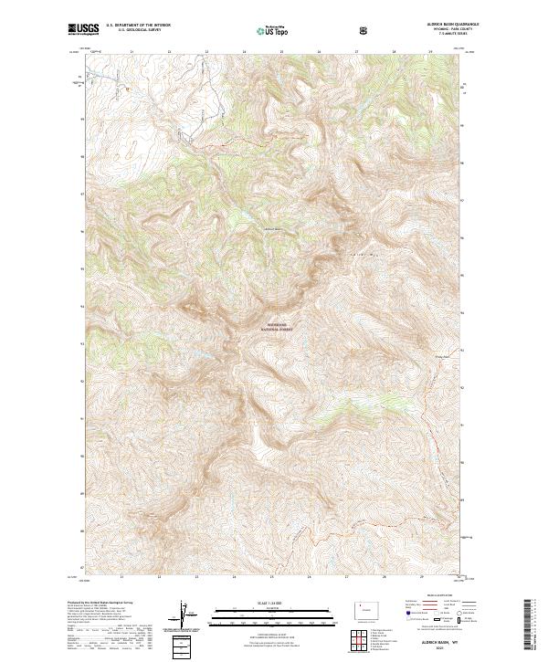
2021 Map of Aldrich Basin
USGS Topo · Published 2021About this map
Shoshone National Forest dominates this high-altitude landscape in Park County, where the massive profile of Carter Mtn rises above the drainage networks of the Absaroka Range. The topography is defined by the significant depression of Aldrich Basin and the strategic high point of Piney Pass. Access through this wilderness area is marked by a series of pack trails, including the Aldrich Creek Trl and the Piney Creek Trl, which follow the natural contours of the steep canyons and ridges. Numerous watercourses, such as Little Boulder Cr, Warhouse Cr, and Betty Cr, dissect the terrain, providing a look at the intricate hydrography that feeds into the larger regional watersheds. This survey documents the remote backcountry as it existed in the early twenty-first century, emphasizing the land's management under federal forest service jurisdiction.
Find a feature on this map
21 named features on this map. Tap any name to fly to it.
Don’t see what you’re looking for? This feature index may not catch every label — zoom into the map to look around manually.
Map Details
Editions of this 2021 Aldrich Basin Map
This is the sole edition of this map. No revisions or reprints were ever made.
Other maps of this area

1893 · Ishawooa
USGS Topo · 1:125,000

1895 · Ishawooa
USGS Topo · 1:125,000

1899 · Ishawooa
USGS Topo · 1:125,000

1955 · Cody
USGS Topo · 1:250,000

1957 · Wapiti
USGS Topo · 1:62,500

1957 · Irish Rock
USGS Topo · 1:62,500

1958 · Cody
USGS Topo · 1:250,000

1962 · Cody
USGS Topo · 1:250,000
1970 · Ptarmigan Mountain
USGS Topo · 1:24,000
1970 · Needle Mountain
USGS Topo · 1:24,000