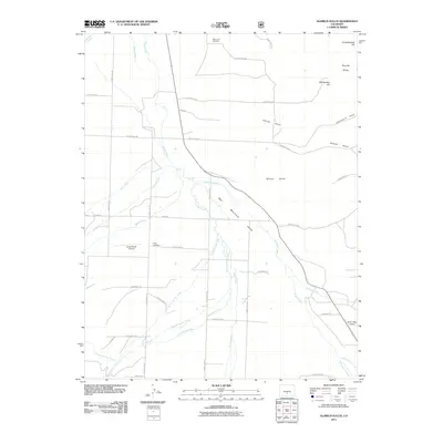
2011 Map of Aldrich Gulch
USGS Topo · Published 2011About this map
The Wet Mountain Valley serves as a prominent geographic corridor in this section of Custer County, where high-altitude ranching and rural development are defined by the many drainage systems descending from the surrounding peaks. Waterways such as Grape Creek, Antelope Creek, and Horn Creek dissect the landscape, creating a complex hydrographic network that historically dictated property lines and transportation routes. In the northern reaches, Silver Cliff Cemetery remains a significant site for local genealogy, while Hope Cemetery sits further south near Horn Rd. The presence of Geary Ranch Airport and Silver West Airport indicates the importance of private aviation in navigating this expansive terrain. From the heights of the Rosita Hills and Knickerbocker Hill to the depths of Aldrich Gulch, this 2011 survey documents a landscape of scattered rural residences connected by a web of county roads including County Rd-129 and County Rd-119.
Find a feature on this map
48 named features on this map. Tap any name to fly to it.
Don’t see what you’re looking for? This feature index may not catch every label — zoom into the map to look around manually.
Map Details
Editions of this 2011 Aldrich Gulch Map
This is the sole edition of this map. No revisions or reprints were ever made.
Other maps of this area

1889 · Canon City
USGS Topo · 1:125,000

1889 · Huerfano Park
USGS Topo · 1:125,000

1892 · Huerfano Park
USGS Topo · 1:125,000

1892 · Canon City
USGS Topo · 1:125,000

1954 · Mount Tyndall
USGS Topo · 1:24,000

1954 · Rosita
USGS Topo · 1:24,000

1954 · Trinidad
USGS Topo · 1:250,000

1954 · Pueblo
USGS Topo · 1:250,000

1955 · Westcliffe
USGS Topo · 1:24,000

1955 · Trinidad
USGS Topo · 1:250,000