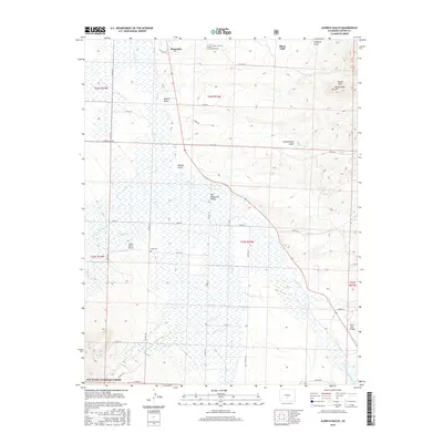
2016 Map of Aldrich Gulch
USGS Topo · Published 2016About this map
Westcliffe and Silver Cliff sit at the northern edge of this high-elevation landscape, where the wide floor of the Wet Mountain Valley meets the rising terrain of the Rosita Hills. The area is defined by a complex network of seasonal drainages and creeks, including Grape Cr and Antelope Cr, which move water through the valley toward the south and west. Significant local history is preserved in the location of the Silver Cliff Cem and Hope Cem, while the southwest corner of the map transitions into the protected lands of the San Isabel National Forest. Aviation history is represented by the Geary Ranch Airport and Silver West Airport, serving this remote cattle and mining region. The landscape is marked by deep geographic cuts like Aldrich Gulch and Leavenworth Gulch, reflecting the rugged drainage patterns that shaped the settlement of Custer County.
Find a feature on this map
50 named features on this map. Tap any name to fly to it.
Don’t see what you’re looking for? This feature index may not catch every label — zoom into the map to look around manually.
Map Details
Editions of this 2016 Aldrich Gulch Map
This is the sole edition of this map. No revisions or reprints were ever made.
Other maps of this area

1889 · Canon City
USGS Topo · 1:125,000

1889 · Huerfano Park
USGS Topo · 1:125,000

1892 · Huerfano Park
USGS Topo · 1:125,000

1892 · Canon City
USGS Topo · 1:125,000

1954 · Mount Tyndall
USGS Topo · 1:24,000

1954 · Rosita
USGS Topo · 1:24,000

1954 · Trinidad
USGS Topo · 1:250,000

1954 · Pueblo
USGS Topo · 1:250,000

1955 · Westcliffe
USGS Topo · 1:24,000

1955 · Trinidad
USGS Topo · 1:250,000