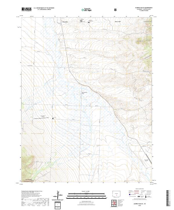
2022 Map of Aldrich Gulch
USGS Topo · Published 2022About this map
The Wet Mountain Valley dominates this high-altitude landscape, where the neighboring settlements of Westcliffe and Silver Cliff sit at the northern edge of the sheet. This area reflects a classic transition between the alluvial valley floor and the rising peaks of the San Isabel National Forest to the south. The drainage network is particularly dense here, with numerous creeks such as Grape Cr, Antelope Cr, and Horn Cr flowing out of the surrounding heights. Local heritage is well-preserved through several established burial grounds, including the Silver Cliff Cem, Hope Cem, and the Assumption Catholic Cem. To the east, the topography becomes more complex as the terrain ascends into the Rosita Hills, marked by distinctive features like Rattlesnake Hill and Knickerbocker Hill. The inclusion of both Silver West Airport and Geary Ranch Airport indicates the modern infrastructure serving this rural Custer County ranching and mountain community.
Find a feature on this map
56 named features on this map. Tap any name to fly to it.
Don’t see what you’re looking for? This feature index may not catch every label — zoom into the map to look around manually.
Map Details
Editions of this 2022 Aldrich Gulch Map
This is the sole edition of this map. No revisions or reprints were ever made.
Other maps of this area

1889 · Canon City
USGS Topo · 1:125,000

1889 · Huerfano Park
USGS Topo · 1:125,000

1892 · Huerfano Park
USGS Topo · 1:125,000

1892 · Canon City
USGS Topo · 1:125,000

1954 · Mount Tyndall
USGS Topo · 1:24,000

1954 · Rosita
USGS Topo · 1:24,000

1954 · Trinidad
USGS Topo · 1:250,000

1954 · Pueblo
USGS Topo · 1:250,000

1955 · Westcliffe
USGS Topo · 1:24,000

1955 · Trinidad
USGS Topo · 1:250,000