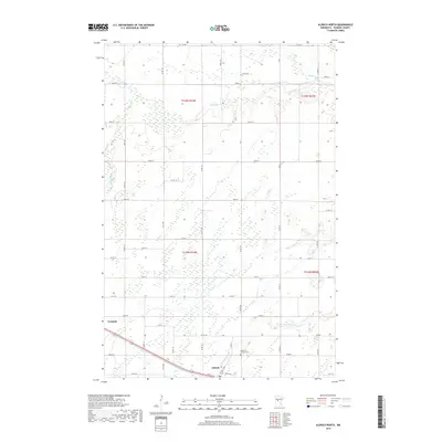
2019 Map of Aldrich North
USGS Topo · Published 2019About this map
Verndale and Aldrich anchor the southern reaches of this landscape, situated along a transportation corridor that includes Main St W. This 2019 survey reveals a terrain defined by complex water systems, where the Leaf River and Redeye River meander through the northern sections while the Partridge River and Wing River drain the southern areas. The abundance of wetlands and drainage patterns suggests a history of agricultural adaptation and land management in this part of Wadena County. Local heritage is preserved at the Mother of Sorrows Cem near Aldrich, providing a specific point of interest for genealogists. The map's grid of county roads, such as Co Rd 118 and Co Rd 26, illustrates the modern connectivity between these rural Minnesota townships.
Find a feature on this map
44 named features on this map. Tap any name to fly to it.
Don’t see what you’re looking for? This feature index may not catch every label — zoom into the map to look around manually.
Map Details
Editions of this 2019 Aldrich North Map
This is the sole edition of this map. No revisions or reprints were ever made.
Other maps of this area

1953 · Brainerd
USGS Topo · 1:250,000

1957 · Brainerd
USGS Topo · 1:250,000

1958 · Brainerd
USGS Topo · 1:250,000

1965 · Brainerd
USGS Topo · 1:250,000

1966 · Staples NE
USGS Topo · 1:24,000

1966 · Staples
USGS Topo · 1:24,000

1966 · Aldrich North
USGS Topo · 1:24,000

1966 · Aldrich South
USGS Topo · 1:24,000

1969 · Bertha
USGS Topo · 1:24,000

1969 · Verndale
USGS Topo · 1:24,000