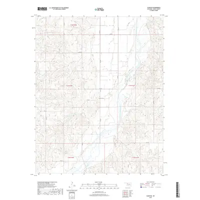
2018 Map of Aledo NE
USGS Topo · Published 2018About this map
The Canadian River cuts a wide, braided path through the southeastern portion of this Dewey County landscape, defining the local drainage and topography. To the north, the terrain is shaped by several smaller watercourses, including Sand Cr, Lone Cr, and Done Cr, which feed into the larger river system. A prominent local landmark, the Raymond Cem, sits near the center of the sheet, providing a primary point of interest for genealogists and local historians researching the early families of this rural section of Oklahoma. Agricultural and water management features are evident in the presence of the Chain Number 3 Reservoir. The area is organized by a grid of rural roads such as n2210 RD and e0740 RD, reflecting the persistent section-line development typical of the state’s agricultural heartland.
Find a feature on this map
26 named features on this map. Tap any name to fly to it.
Don’t see what you’re looking for? This feature index may not catch every label — zoom into the map to look around manually.
Map Details
Editions of this 2018 Aledo NE Map
This is the sole edition of this map. No revisions or reprints were ever made.
Other maps of this area

1955 · Clinton
USGS Topo · 1:250,000

1955 · Woodward
USGS Topo · 1:250,000

1957 · Clinton
USGS Topo · 1:250,000

1958 · Woodward
USGS Topo · 1:250,000

1962 · Putnam
USGS Topo · 1:62,500

1962 · Aledo
USGS Topo · 1:62,500

1969 · Mutual SW
USGS Topo · 1:24,000

1969 · Lenora
USGS Topo · 1:24,000
1972 · Taloga
USGS Topo · 1:24,000

1984 · Foss Reservoir
USGS Topo · 1:100,000