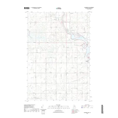
2018 Map of Alexander Lake
USGS Topo · Published 2018About this map
Alexander Lake and the winding Wisconsin River dominate the northern portion of this landscape, marking a point where the river widens significantly before continuing its southward flow. West of the river, the terrain is characterized by a complex network of waterways, including the New Wood River, Copper River, and Garrison Creek, which snake through wetlands like Baggs Marsh. This hydrographic pattern suggests a low-lying, water-rich environment that has historically influenced local road placement and land use.
Find a feature on this map
61 named features on this map. Tap any name to fly to it.
Don’t see what you’re looking for? This feature index may not catch every label — zoom into the map to look around manually.
Map Details
Editions of this 2018 Alexander Lake Map
This is the sole edition of this map. No revisions or reprints were ever made.
Other maps of this area

1899 · Wausau
USGS Topo · 1:125,000

1902 · Wausau
USGS Topo · 1:125,000

1902 · Marathon
USGS Topo · 1:125,000

1950 · Tomahawk
USGS Topo · 1:48,000

1950 · Spirit Falls
USGS Topo · 1:48,000

1951 · Merrill
USGS Topo · 1:48,000

1951 · Hamburg
USGS Topo · 1:48,000

1952 · Spirit Falls
USGS Topo · 1:48,000

1952 · Tomahawk
USGS Topo · 1:48,000

1954 · Iron Mountain
USGS Topo · 1:250,000