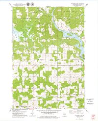
1978 Map of Alexander Lake
USGS Topo · Published 1979About this map
The Wisconsin River dominates this Lincoln County landscape, widening significantly at Alexander Lake and the Alexander Dam. The map reveals a transition between the developed Merrill corporate boundary and the surrounding rural townships of Harding, Rock Falls, and Corning. To the west, the vast Bagga Marsh and a dedicated Cranberry Bog signify the region's specialized agricultural and wetland heritage. Local social centers are anchored by landmarks such as the Townhall, the Scott Sch, and several rural churches including St Pauls Ch. The presence of several family-named roads, like Joe Snow Road and Ohloff Avenue, alongside the Methodist Cem and Snow Hill Cem, provides a detailed geographic record for genealogists researching the area's mid-century rural community structure.
Find a feature on this map
41 named features on this map. Tap any name to fly to it.
Don’t see what you’re looking for? This feature index may not catch every label — zoom into the map to look around manually.
Map Details
Editions of this 1978 Alexander Lake Map
This is the sole edition of this map. No revisions or reprints were ever made.
Other maps of this area

1899 · Wausau
USGS Topo · 1:125,000

1902 · Wausau
USGS Topo · 1:125,000

1902 · Marathon
USGS Topo · 1:125,000

1950 · Tomahawk
USGS Topo · 1:48,000

1950 · Spirit Falls
USGS Topo · 1:48,000

1951 · Merrill
USGS Topo · 1:48,000

1951 · Hamburg
USGS Topo · 1:48,000

1952 · Spirit Falls
USGS Topo · 1:48,000

1952 · Tomahawk
USGS Topo · 1:48,000

1954 · Iron Mountain
USGS Topo · 1:250,000