
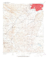
1935 Map of Alexander
USGS Topo · Published 1935About this map
The State Girls Indust Home stands as a notable institutional landmark in this mid-1930s survey of the Pulaski and Saline County border. The landscape is defined by the convergence of the Chicago Rock Island and Pacific and Missouri Pacific railroads, which facilitated the development of early communities like Alexander, Mabelvale, and Bryant. This period captures the area's rural character before extensive suburbanization, showing a dense network of country schools and churches such as Lawson Sch, Quinn Chapel, and Landmark Ch. Topographical detail is anchored by Alexander Mountain, while the industrial future of the region is signaled by the settlement of Bauxite. The map traces the winding paths of Fourche Creek and Hurricane Creek, illustrating how the drainage patterns of the Little Rock outskirts influenced the placement of original homesteads and small post offices like Vimy Ridge and Maple.
Find a feature on this map
65 named features on this map. Tap any name to fly to it.
Don’t see what you’re looking for? This feature index may not catch every label — zoom into the map to look around manually.
Map Details
Editions of this 1935 Alexander Map
2 editions found
Other maps of this area

1890 · Benton
USGS Topo · 1:125,000

1891 · Little Rock
USGS Topo · 1:125,000

1893 · Little Rock
USGS Topo · 1:125,000

1894 · Benton
USGS Topo · 1:125,000

1932 · Pastoria
USGS Topo · 1:62,500

1935 · Mc Almont
USGS Topo · 1:24,000

1935 · Little Rock
USGS Topo · 1:24,000

1935 · Sweet Home
USGS Topo · 1:24,000

1935 · North Little Rock
USGS Topo · 1:24,000

1935 · Pastoria
USGS Topo · 1:62,500