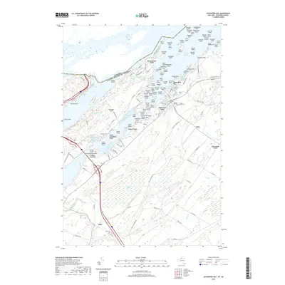
2019 Map of Alexandria Bay
USGS Topo · Published 2019About this map
The Saint Lawrence River serves as a massive international corridor, separating the United States from Canada through a labyrinth of granite islands and narrow channels. Alexandria Bay stands as the primary hub on the American shore, overlooking the American Narrows and the massive Thousand Islands Bridge that connects Collins Landing to the interior of the river archipelago. This 2019 survey documents the density of summer settlements and named island groups, including Westminster Park and the Manhattan Group. Inland from the river, the landscape transitions to a more rural character defined by Mullet Cr and agricultural stretches around Omar and Alexandria Center. For genealogists and local historians, several small burial grounds are identified, such as Saint Cyril's Cem and Houghton Cem, providing a precise record of the regional community and its aviation history at Maxson Airfield.
Find a feature on this map
150 named features on this map. Tap any name to fly to it.
Don’t see what you’re looking for? This feature index may not catch every label — zoom into the map to look around manually.
Map Details
Editions of this 2019 Alexandria Bay Map
This is the sole edition of this map. No revisions or reprints were ever made.
Other maps of this area

1900 · Clayton
USGS Topo · 1:62,500

1903 · Grindstone
USGS Topo · 1:62,500

1903 · Clayton
USGS Topo · 1:62,500

1903 · Alexandria Bay
USGS Topo · 1:62,500

1903 · Theresa
USGS Topo · 1:62,500

1942 · Clayton
USGS Topo · 1:24,000

1943 · Thousand Island Park
USGS Topo · 1:31,680

1943 · Redwood
USGS Topo · 1:31,680

1943 · Clayton
USGS Topo · 1:31,680

1943 · Lafargeville
USGS Topo · 1:31,680