
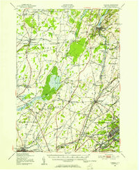
1943 Map of Redwood
USGS Topo · Published 1943About this map
Redwood serves as the primary hub for this Northern New York landscape, situated at a junction of the New York Central railroad and a network of water bodies. The settlement patterns in the towns of Alexandria and Theresa are defined by a dense concentration of local institutions, including nearly a dozen numbered schools such as School No 14 and School No 23. This 1940s survey, mapped by the Tennessee Valley Authority for the War Department, captures a transitional era of rural life where family legacies are marked by the Barnes Cem, McDonald Cem, and Hill Cem. The geography is dominated by a complex system of interconnected waters including Butterfield Lake, Millsite Lake, and the Indian River, which supported the local economy alongside the rail traffic moving through Plessis and Browns Corners. Along the shore of Goose Bay, Kring Point State Park and Picnic Island highlight the region's early recreational importance.
Find a feature on this map
51 named features on this map. Tap any name to fly to it.
Don’t see what you’re looking for? This feature index may not catch every label — zoom into the map to look around manually.
Map Details
Editions of this 1943 Redwood Map
This is the sole edition of this map. No revisions or reprints were ever made.
Other maps of this area

1903 · Alexandria Bay
USGS Topo · 1:62,500

1903 · Theresa
USGS Topo · 1:62,500

1911 · Antwerp
USGS Topo · 1:62,500

1912 · Hammond
USGS Topo · 1:62,500

1943 · Lafargeville
USGS Topo · 1:31,680

1943 · Alexandria Bay
USGS Topo · 1:31,680

1944 · Hammond
USGS Topo · 1:62,500

1948 · Theresa
USGS Topo · 1:24,000

1948 · Chippewa Bay
USGS Topo · 1:24,000
1948 · Theresa
USGS Topo · 1:62,500