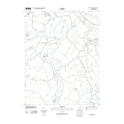
2010 Map of Alexandria
USGS Topo · Published 2010About this map
The Licking River winds in a serpentine course through this portion of Kenton and Campbell Counties, creating distinctive landmarks like Grants Bend and defining the local topography. The landscape is dotted with several small communities and residential enclaves, including Ryland Heights, Visalia, and Latonia Lakes. Near the eastern edge, the seat of Alexandria features the Alexandria Fairgrounds and Saint Mary's Cemetery.
Find a feature on this map
90 named features on this map. Tap any name to fly to it.
Don’t see what you’re looking for? This feature index may not catch every label — zoom into the map to look around manually.
Map Details
Editions of this 2010 Alexandria Map
This is the sole edition of this map. No revisions or reprints were ever made.
Other maps of this area

1898 · East Cincinnati
USGS Topo · 1:62,500

1914 · East Cincinnati
USGS Topo · 1:62,500

1914 · West Cincinnati
USGS Topo · 1:62,500

1929 · Alexandria
USGS Topo · 1:48,000

1936 · Alexandria
USGS Topo · 1:62,500

1950 · Independence
USGS Topo · 1:24,000

1950 · Walton
USGS Topo · 1:24,000

1950 · Covington
USGS Topo · 1:24,000

1952 · Newport
USGS Topo · 1:24,000

1953 · Withamsville
USGS Topo · 1:24,000