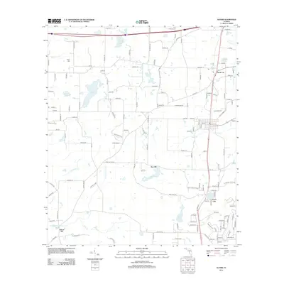
2012 Map of Alford
USGS Topo · Published 2012About this map
Hard Labor Cr and Little Hard Labor Cr meander through this north Florida landscape, shaping a terrain defined by its water and agricultural heritage. Small clusters of community identity like Steele City, Orange Hill Corners, and Round Lake anchor the region, connected by a network of family-named roads and rural routes. The map records the local importance of early industry and community life, marked by sites such as Kent Mill near its namesake lake and Gilberts Mill to the southwest.
Find a feature on this map
143 named features on this map. Tap any name to fly to it.
Don’t see what you’re looking for? This feature index may not catch every label — zoom into the map to look around manually.
Map Details
Editions of this 2012 Alford Map
This is the sole edition of this map. No revisions or reprints were ever made.
Other maps of this area

1950 · Chipley
USGS Topo · 1:24,000

1950 · Wausau
USGS Topo · 1:24,000

1950 · Gap Lake
USGS Topo · 1:24,000

1951 · Chipley
USGS Topo · 1:24,000

1951 · Wausau
USGS Topo · 1:24,000

1951 · Gap Pond
USGS Topo · 1:24,000

1952 · Kynesville
USGS Topo · 1:24,000

1952 · Alford SE
USGS Topo · 1:24,000

1952 · Cottondale East
USGS Topo · 1:24,000

1952 · Cottondale West
USGS Topo · 1:24,000