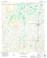
1994 Map of Alford
USGS Topo · Published 1995About this map
Alford serves as the central hub of this north Florida landscape, where the local economy and geography are defined by a unique network of depressional wetlands known as bays and ponds. Small communities like Steele City and Round Lake are interconnected by a system of rural roads and light-duty highways, while the surrounding countryside is dotted with numerous local landmarks including Gilberts Mill and several community churches such as Macedonia Ch and Cypress Creek Ch.
Find a feature on this map
52 named features on this map. Tap any name to fly to it.
Don’t see what you’re looking for? This feature index may not catch every label — zoom into the map to look around manually.
Map Details
Editions of this 1994 Alford Map
This is the sole edition of this map. No revisions or reprints were ever made.
Other maps of this area

1950 · Chipley
USGS Topo · 1:24,000

1950 · Wausau
USGS Topo · 1:24,000

1950 · Gap Lake
USGS Topo · 1:24,000

1951 · Chipley
USGS Topo · 1:24,000

1951 · Wausau
USGS Topo · 1:24,000

1951 · Gap Pond
USGS Topo · 1:24,000

1952 · Kynesville
USGS Topo · 1:24,000

1952 · Alford SE
USGS Topo · 1:24,000

1952 · Cottondale East
USGS Topo · 1:24,000

1952 · Cottondale West
USGS Topo · 1:24,000