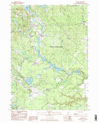
1983 Map of Alfred
USGS Topo · Published 1984About this map
The town of Alfred, acting as a central hub in York County, is detailed here alongside the sprawling Massabesic Experimental Forest. The landscape is defined by the winding Mousam River and the Middle Littlefield River Branch, which support a series of water bodies including Shaker Pond, Bunganut Pond, and the expansive Estes Lake. The map reveals a transition between established town centers and industrial activity, evidenced by the Sanford Municipal Airport and various sand and gravel pits. Smaller settlements like Alfred Mills and Spang Mills reflect the area's milling history, while the presence of the County Jail and Evergreen Cem provides specific points of interest for genealogists and local historians. To the south, the expansion of South Sanford contrasts with the preserved woodlands and marshes such as Perkins Marsh Brook.
Find a feature on this map
56 named features on this map. Tap any name to fly to it.
Don’t see what you’re looking for? This feature index may not catch every label — zoom into the map to look around manually.
Map Details
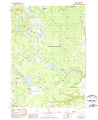
Editions of this 1983 Alfred Map
2 editions found
Other maps of this area

1891 · Berwick
USGS Topo · 1:62,500

1891 · Kennebunk
USGS Topo · 1:62,500

1891 · Buxton
USGS Topo · 1:62,500

1891 · Newfield
USGS Topo · 1:62,500

1892 · Buxton
USGS Topo · 1:62,500

1893 · Kennebunk
USGS Topo · 1:62,500

1893 · Berwick
USGS Topo · 1:62,500

1893 · Buxton
USGS Topo · 1:62,500

1893 · Newfield
USGS Topo · 1:62,500

1898 · Kennebunk
USGS Topo · 1:62,500