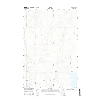
2014 Map of Alice
USGS Topo · Published 2014About this map
The small prairie settlement of Alice serves as the focal point of this North Dakota landscape, situated at the intersection of CR-38 and 6th Ave. The surrounding Cass County terrain is defined by the wandering path of the Maple River, which cuts through the southwestern and northwestern corners of the map. To the east, the waters of Lake Bertha and the drainage of Buffalo Cr illustrate the subtle glacial depressions characteristic of this region. The map reveals a rigid section-line grid of rural roads, including 45th St SE and 139th Ave SE, which organize the vast agricultural reaches. This 2014 survey documents the enduring spatial layout of an area where the human footprint is small and strictly aligned to the cardinal directions of the Great Plains.
Find a feature on this map
20 named features on this map. Tap any name to fly to it.
Don’t see what you’re looking for? This feature index may not catch every label — zoom into the map to look around manually.
Map Details
Editions of this 2014 Alice Map
This is the sole edition of this map. No revisions or reprints were ever made.
Other maps of this area

1895 · Casselton
USGS Topo · 1:125,000

1897 · Tower
USGS Topo · 1:125,000

1897 · Casselton
USGS Topo · 1:125,000

1953 · Fargo
USGS Topo · 1:250,000

1956 · Fargo
USGS Topo · 1:250,000

1961 · Sheldon NW
USGS Topo · 1:24,000

1961 · Enderlin North
USGS Topo · 1:24,000

1965 · Alice
USGS Topo · 1:24,000

1965 · Lucca
USGS Topo · 1:24,000

1965 · Tower City SW
USGS Topo · 1:24,000