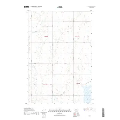
2020 Map of Alice
USGS Topo · Published 2020About this map
Alice serves as the primary hub for this section of Cass County, defined by a classic grid of section lines and gravel roads that crisscross the prairie landscape. The Alice Community Cem sits just south of the main town site, providing a clear reference point for local genealogy and family history research. The terrain is notably water-rich, characterized by the winding path of the Maple River and the eastern flow of Buffalo Cr. To the southeast, the expansive Lake Bertha and the Wetlands & Waterfowl Trail highlight the significance of the region's natural hydrography and conservation efforts. Surveyed in the 21st century, the map illustrates how township and range lines, such as t138n r55w, continue to organize the agricultural life of the North Dakota plains, showing the persistent structure of rural settlement and land management.
Find a feature on this map
25 named features on this map. Tap any name to fly to it.
Don’t see what you’re looking for? This feature index may not catch every label — zoom into the map to look around manually.
Map Details
Editions of this 2020 Alice Map
This is the sole edition of this map. No revisions or reprints were ever made.
Other maps of this area

1895 · Casselton
USGS Topo · 1:125,000

1897 · Tower
USGS Topo · 1:125,000

1897 · Casselton
USGS Topo · 1:125,000

1953 · Fargo
USGS Topo · 1:250,000

1956 · Fargo
USGS Topo · 1:250,000

1961 · Sheldon NW
USGS Topo · 1:24,000

1961 · Enderlin North
USGS Topo · 1:24,000

1965 · Alice
USGS Topo · 1:24,000

1965 · Lucca
USGS Topo · 1:24,000

1965 · Tower City SW
USGS Topo · 1:24,000