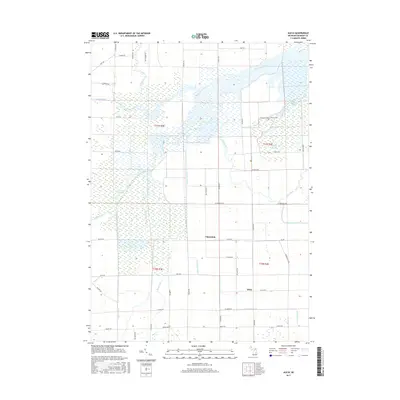
2017 Map of Alicia
USGS Topo · Published 2017About this map
The Shiawassee River and Flint River converge in this wetland-heavy landscape of Saginaw County, where a complex network of bayous and creeks defines the local topography. Small agricultural settlements like Alicia and Clausedale are positioned amidst a grid of rural roads, including Alicia Rd and Clausedale Rd. The area is characterized by extensive marshes and waterways such as Ferguson Bayou, Crystal Bayou, and Kimberly Bayou, illustrating a landscape deeply influenced by the Shiawassee basin's drainage patterns. Historical land divisions are clearly marked by township and range lines like t11n r3e and t10n r4e, providing a precise framework for genealogical and property research. Conservation and recreation are evident through the Ferguson Bayou Nature Trail, which winds through the riverine environment near the confluence of several major tributaries including the Bad River and Misteguay Creek.
Find a feature on this map
57 named features on this map. Tap any name to fly to it.
Don’t see what you’re looking for? This feature index may not catch every label — zoom into the map to look around manually.
Map Details
Editions of this 2017 Alicia Map
This is the sole edition of this map. No revisions or reprints were ever made.
Other maps of this area

1917 · Chesaning
USGS Topo · 1:62,500

1917 · St. Charles
USGS Topo · 1:62,500

1919 · Saginaw
USGS Topo · 1:62,500

1919 · Burt
USGS Topo · 1:62,500

1921 · Burt
USGS Topo · 1:62,500

1941 · Saginaw
USGS Topo · 1:62,500

1943 · Burt
USGS Topo · 1:62,500

1943 · Chesaning
USGS Topo · 1:62,500

1943 · Saginaw
USGS Topo · 1:62,500

1943 · St. Charles
USGS Topo · 1:62,500
Featured Places
- Albee Township, MI
- Swan Creek Township, MI
- James Township, MI
- Spaulding Township, MI
- Saint Charles Township, MI