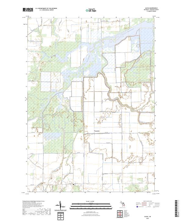
2023 Map of Alicia
USGS Topo · Published 2023About this map
The confluence of major river systems defines this part of Saginaw County, where the Shiawassee River, Flint River, and Bad River converge into a complex network of wetlands and bayous. This modern survey illustrates how water continues to shape the landscape near the small settlement of Clausedale. The area is characterized by an intricate drainage system including Wolf Creek, Misteguay Creek, and Fairchild Creek, alongside numerous named bayous such as Crystal Bayou and Kimberly Bayou. For those tracing local history, the Indiantown Cem stands near the southern boundary along Fergus Rd. Contemporary land use is reflected in the emergence of recreational corridors like the Flint River Water Trl and the Ferguson Bayou Nature Trl, which navigate the seasonally flooded lowlands that have long dictated the placement of roads like Ryan Rd and Alicia Rd.
Find a feature on this map
56 named features on this map. Tap any name to fly to it.
Don’t see what you’re looking for? This feature index may not catch every label — zoom into the map to look around manually.
Map Details
Editions of this 2023 Alicia Map
This is the sole edition of this map. No revisions or reprints were ever made.
Other maps of this area

1917 · Chesaning
USGS Topo · 1:62,500

1917 · St. Charles
USGS Topo · 1:62,500

1919 · Saginaw
USGS Topo · 1:62,500

1919 · Burt
USGS Topo · 1:62,500

1921 · Burt
USGS Topo · 1:62,500

1941 · Saginaw
USGS Topo · 1:62,500

1943 · Burt
USGS Topo · 1:62,500

1943 · Chesaning
USGS Topo · 1:62,500

1943 · Saginaw
USGS Topo · 1:62,500

1943 · St. Charles
USGS Topo · 1:62,500