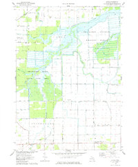
1975 Map of Alicia
USGS Topo · Published 1978About this map
The Shiawassee National Wildlife Refuge and the Shiawassee River State Game Area dominate this landscape in the mid-1970s, where the Shiawassee River, Flint River, and Bad River converge into a complex network of wetlands and bayous. This area serves as a significant drainage basin for central Michigan, as evidenced by the numerous named waterways like Ferguson Bayou and Misteguay Creek that feed the river system.
Find a feature on this map
44 named features on this map. Tap any name to fly to it.
Don’t see what you’re looking for? This feature index may not catch every label — zoom into the map to look around manually.
Map Details
Editions of this 1975 Alicia Map
This is the sole edition of this map. No revisions or reprints were ever made.
Other maps of this area

1917 · Chesaning
USGS Topo · 1:62,500

1917 · St. Charles
USGS Topo · 1:62,500

1919 · Saginaw
USGS Topo · 1:62,500

1919 · Burt
USGS Topo · 1:62,500

1921 · Burt
USGS Topo · 1:62,500

1941 · Saginaw
USGS Topo · 1:62,500

1943 · Burt
USGS Topo · 1:62,500

1943 · Chesaning
USGS Topo · 1:62,500

1943 · Saginaw
USGS Topo · 1:62,500

1943 · St. Charles
USGS Topo · 1:62,500