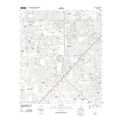
2010 Map of Alief
USGS Topo · Published 2010About this map
Brays Bayou and Keegans Bayou wind through a landscape defined by rapid suburban expansion and dense residential development in the southwest Houston area. This map reveals the intricate network of master-planned neighborhoods like Ashford Village, Sharpstown, and Bellaire West that transformed former prairies into a complex urban grid. The presence of long-established landmarks such as Forest Park Cemetery and Alief Cemetery provides a historical anchor amidst the newer commercial developments like The Retail Centre on Bissonnet. The convergence of major thoroughfares including Beltway 8 and US Hwy 90 Alt illustrates the transport-driven growth that unified the area between Sugar Land and Missouri City, while smaller features like Cleveland Lake remain as natural vestiges of the original drainage systems.
Find a feature on this map
79 named features on this map. Tap any name to fly to it.
Don’t see what you’re looking for? This feature index may not catch every label — zoom into the map to look around manually.
Map Details
Editions of this 2010 Alief Map
This is the sole edition of this map. No revisions or reprints were ever made.
Other maps of this area

1915 · Bellaire
USGS Topo · 1:24,000

1915 · Houston Heights
USGS Topo · 1:24,000

1915 · Alief
USGS Topo · 1:24,000

1915 · Addicks
USGS Topo · 1:24,000

1915 · Hillendahl
USGS Topo · 1:24,000

1915 · Clodine
USGS Topo · 1:24,000

1918 · Addicks
USGS Topo · 1:31,680

1918 · Hillendahl
USGS Topo · 1:31,680

1919 · Clodine
USGS Topo · 1:31,680

1920 · Almeda
USGS Topo · 1:31,680