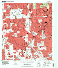
1995 Map of Alief
USGS Topo · Published 1998About this map
Suburban expansion defines this portion of western Houston and the surrounding communities of Alief and Stafford. The map reveals a dense network of major thoroughfares like the Sam Houston Tollway and Westheimer Road, reflecting the rapid mid-90s development of the Texas Gulf Coast. Among the residential subdivisions, several notable landmarks remain, including the now-historical Andrau Airpark and major retail hubs like Sharpstown Mall and Westwood Mall. The cultural landscape is anchored by institutions such as Houston Baptist University and the St Cyril Ch, while the region's earlier rural roots are still visible in the scattered burial grounds of the Alief Brethren Cem and Riceville Cem. The natural drainage of the area is governed by the eastward-flowing Brays Bayou and Buffalo Bayou, which are tightly hemmed in by residential streets and commercial centers.
Find a feature on this map
74 named features on this map. Tap any name to fly to it.
Don’t see what you’re looking for? This feature index may not catch every label — zoom into the map to look around manually.
Map Details
Editions of this 1995 Alief Map
This is the sole edition of this map. No revisions or reprints were ever made.
Other maps of this area

1915 · Bellaire
USGS Topo · 1:24,000

1915 · Houston Heights
USGS Topo · 1:24,000

1915 · Alief
USGS Topo · 1:24,000

1915 · Addicks
USGS Topo · 1:24,000

1915 · Hillendahl
USGS Topo · 1:24,000

1915 · Clodine
USGS Topo · 1:24,000

1918 · Addicks
USGS Topo · 1:31,680

1918 · Hillendahl
USGS Topo · 1:31,680

1919 · Clodine
USGS Topo · 1:31,680

1920 · Almeda
USGS Topo · 1:31,680