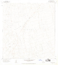
1967 Map of Alika Cone
USGS Topo · Published 1968About this map
The Southwest Rift Zone dominates this mid-century survey of the Kahuku region, where the active volcanic landscape of the Big Island is recorded through several distinct eruptive periods. The map provides a detailed chronological layout of recent activity, specifically identifying the massive Lava Flow of 1950 alongside the earlier Alika Lava Flow of 1919 and the Lava Flow of 1926. These flows created a stark environment where older terrain persists only in isolated pockets like Kipuka Nene.
Find a feature on this map
11 named features on this map. Tap any name to fly to it.
Don’t see what you’re looking for? This feature index may not catch every label — zoom into the map to look around manually.
Map Details
Editions of this 1967 Alika Cone Map
This is the sole edition of this map. No revisions or reprints were ever made.
Other maps of this area

1924 · Honuapo
USGS Topo · 1:62,500

1928 · Mauna Loa
USGS Topo · 1:62,500

1928 · Hoopuloa
USGS Topo · 1:62,500

1954 · Hawaii South
USGS Topo · 1:250,000

1959 · Hawaii South
USGS Topo · 1:250,000
1960 · Kaunene
USGS Topo · 1:24,000

1961 · Hawaii South
USGS Topo · 1:250,000

1962 · Hawaii South
USGS Topo · 1:250,000

1962 · Papa
USGS Topo · 1:24,000
1963 · Puu Pohakuloa
USGS Topo · 1:24,000