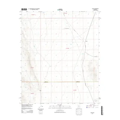
2013 Map of Alivio
USGS Topo · Published 2013About this map
Alivio sits within a landscape defined by cattle ranching infrastructure and intermittent water sources on the border of Sierra and Dona Ana counties. The terrain is marked by essential desert water catchments such as Barbee Tank, Hidden Tank, and the uniquely named Upside Down Tank, which illustrate the critical importance of water management in this arid region. The geography transitions from the southern reaches of Canon Avendijo toward the prominent McLeod Hills in the southwest corner. Transportation in this area relies on a network of rural routes including Co Road A013 and Powerline Rd, reflecting the sparse settlement and utilitarian nature of the territory. Notable landmarks like Toby Hole and Point of Rocks Tank provide distinct orientation points for local history researchers studying the ranching heritage and land use of the Jornada del Muerto region.
Find a feature on this map
23 named features on this map. Tap any name to fly to it.
Don’t see what you’re looking for? This feature index may not catch every label — zoom into the map to look around manually.
Map Details
Editions of this 2013 Alivio Map
This is the sole edition of this map. No revisions or reprints were ever made.
Other maps of this area

1916 · Tonuco
USGS Topo · 1:125,000

1932 · Tonuco
USGS Topo · 1:125,000

1948 · Chicken Well
USGS Topo · 1:62,500

1948 · San Diego Mountain
USGS Topo · 1:62,500

1955 · Las Cruces
USGS Topo · 1:250,000

1958 · Las Cruces
USGS Topo · 1:250,000

1959 · Hatch
USGS Topo · 1:24,000

1959 · Rincon
USGS Topo · 1:24,000

1959 · Upham
USGS Topo · 1:62,500
1981 · Prisor Hill
USGS Topo · 1:24,000