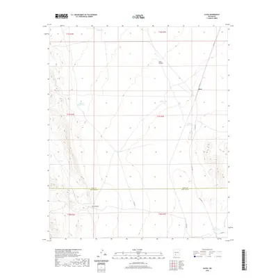
2020 Map of Alivio
USGS Topo · Published 2020About this map
The settlement of Alivio sits along a primary corridor on the eastern side of this High Desert landscape, where the topography transitions from the southern McLeod Hills toward more level plains. This 2020 survey illustrates a ranching-dependent geography defined by an intricate network of water catchments, including Toby Hole, Hayfield Tank, and Point of Rocks Tank. The presence of these named tanks and the seasonal drainage of Rincon Arroyo indicate a landscape where managing water is the primary driver of human land use. Transportation is anchored by several county routes, such as Co RD a013 and Co RD e070, which connect these remote resources. The map also documents the dividing line between Sierra County and Doña Ana County, providing a modern view of jurisdictional boundaries amidst the rugged terrain of Cañon Avendijo.
Find a feature on this map
23 named features on this map. Tap any name to fly to it.
Don’t see what you’re looking for? This feature index may not catch every label — zoom into the map to look around manually.
Map Details
Editions of this 2020 Alivio Map
This is the sole edition of this map. No revisions or reprints were ever made.
Other maps of this area

1916 · Tonuco
USGS Topo · 1:125,000

1932 · Tonuco
USGS Topo · 1:125,000

1948 · Chicken Well
USGS Topo · 1:62,500

1948 · San Diego Mountain
USGS Topo · 1:62,500

1955 · Las Cruces
USGS Topo · 1:250,000

1958 · Las Cruces
USGS Topo · 1:250,000

1959 · Hatch
USGS Topo · 1:24,000

1959 · Rincon
USGS Topo · 1:24,000

1959 · Upham
USGS Topo · 1:62,500
1981 · Prisor Hill
USGS Topo · 1:24,000