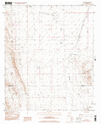
1996 Map of Alivio
USGS Topo · Published 2001About this map
Mcleod Hills and the Caballo Mountains anchor this arid landscape in southern New Mexico, where water management is the primary marker of human presence. The survey documents a network of critical water catchments essential for ranching or survival in the high desert, including Upper Taylor Tank, Hidden Tank, and the curiously named Upside Down Tank. These features are scattered along drainage systems like Barbee Draw and Cañon Barbee, illustrating how the topography dictates movement and utility in this environment.
Find a feature on this map
16 named features on this map. Tap any name to fly to it.
Don’t see what you’re looking for? This feature index may not catch every label — zoom into the map to look around manually.
Map Details
Editions of this 1996 Alivio Map
This is the sole edition of this map. No revisions or reprints were ever made.
Other maps of this area

1916 · Tonuco
USGS Topo · 1:125,000

1932 · Tonuco
USGS Topo · 1:125,000

1948 · Chicken Well
USGS Topo · 1:62,500

1948 · San Diego Mountain
USGS Topo · 1:62,500

1955 · Las Cruces
USGS Topo · 1:250,000

1958 · Las Cruces
USGS Topo · 1:250,000

1959 · Hatch
USGS Topo · 1:24,000

1959 · Rincon
USGS Topo · 1:24,000

1959 · Upham
USGS Topo · 1:62,500
1981 · Prisor Hill
USGS Topo · 1:24,000