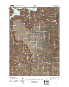
2011 Map of Alkali Flat
USGS Topo · Published 2011About this map
The Prineville Reservoir dominates the northwest corner of this Crook County landscape, where the waters of the Crooked River are held back by the Bowman Dam just out of view. The small settlement of Roberts serves as the local hub, situated near the intersection of SE Salt Creek Rd and SE Roberts Rd. This area is defined by its drainage systems, with Alkali Creek and Bear Creek cutting through the high desert terrain toward the reservoir.
Find a feature on this map
17 named features on this map. Tap any name to fly to it.
Don’t see what you’re looking for? This feature index may not catch every label — zoom into the map to look around manually.
Map Details
Editions of this 2011 Alkali Flat Map
This is the sole edition of this map. No revisions or reprints were ever made.
Other maps of this area

1946 · Eagle Rock
USGS Topo · 1:62,500

1948 · Eagle Rock
USGS Topo · 1:62,500

1955 · Crescent
USGS Topo · 1:250,000

1955 · Bend
USGS Topo · 1:250,000

1957 · Crescent
USGS Topo · 1:250,000

1957 · Bend
USGS Topo · 1:250,000

1958 · Crescent
USGS Topo · 1:250,000

1958 · Bend
USGS Topo · 1:250,000

1962 · Powell Buttes
USGS Topo · 1:62,500

1967 · Brothers NW
USGS Topo · 1:24,000