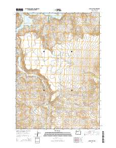
2014 Map of Alkali Flat
USGS Topo · Published 2014About this map
Roberts serves as the primary point of settlement in this high-desert landscape, located just south of the sprawling waters of the Prineville Reservoir. The terrain is defined by a series of drainage networks, including Alkali Cr, Bear Cr, and Salt Cr, which carve through the volcanic topography toward the reservoir basin. Local history and genealogy interests are centered at the Roberts Cem, while topographic landmarks such as Alkali Butte and Windy Point provide clear navigational markers for the surrounding plateau.
Find a feature on this map
18 named features on this map. Tap any name to fly to it.
Don’t see what you’re looking for? This feature index may not catch every label — zoom into the map to look around manually.
Map Details
Editions of this 2014 Alkali Flat Map
This is the sole edition of this map. No revisions or reprints were ever made.
Other maps of this area

1946 · Eagle Rock
USGS Topo · 1:62,500

1948 · Eagle Rock
USGS Topo · 1:62,500

1955 · Crescent
USGS Topo · 1:250,000

1955 · Bend
USGS Topo · 1:250,000

1957 · Crescent
USGS Topo · 1:250,000

1957 · Bend
USGS Topo · 1:250,000

1958 · Crescent
USGS Topo · 1:250,000

1958 · Bend
USGS Topo · 1:250,000

1962 · Powell Buttes
USGS Topo · 1:62,500

1967 · Brothers NW
USGS Topo · 1:24,000