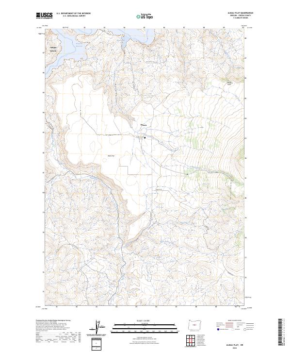
2024 Map of Alkali Flat
USGS Topo · Published 2024About this map
The Maury Mountains rise across the southeastern landscape of this high desert region in Crook County, providing a stark vertical contrast to the eponymous Alkali Flat. The northern edge of the map is dominated by the waters of the Prineville Reservoir, specifically around Roberts Bay and the mouth of Juniper Canyon. This terrain is defined by a series of deep drainages including Birch Canyon and Sanford Creek that feed into the local water system.
Find a feature on this map
24 named features on this map. Tap any name to fly to it.
Don’t see what you’re looking for? This feature index may not catch every label — zoom into the map to look around manually.
Map Details
Editions of this 2024 Alkali Flat Map
This is the sole edition of this map. No revisions or reprints were ever made.
Other maps of this area

1946 · Eagle Rock
USGS Topo · 1:62,500

1948 · Eagle Rock
USGS Topo · 1:62,500

1955 · Crescent
USGS Topo · 1:250,000

1955 · Bend
USGS Topo · 1:250,000

1957 · Crescent
USGS Topo · 1:250,000

1957 · Bend
USGS Topo · 1:250,000

1958 · Crescent
USGS Topo · 1:250,000

1958 · Bend
USGS Topo · 1:250,000

1962 · Powell Buttes
USGS Topo · 1:62,500

1967 · Brothers NW
USGS Topo · 1:24,000