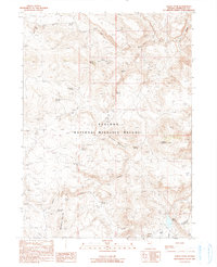
1990 Map of Alkali Peak
USGS Topo · Published 1990About this map
Sheldon National Wildlife Refuge dominates this high-desert landscape in northern Nevada, where water sources dictate the patterns of human and animal movement. The map identifies critical riparian features like Virgin Creek and the strikingly named Hell Creek, along with numerous springs that served as vital landmarks for early ranchers and travelers. The Devaney Camp Site near the center of the sheet and Mc Clusky Spring to the south suggest the area's history as rangeland. The topography is defined by the volcanic rises of Alkali Peak, Devaney Mountain, and Mahogany Mountain. In the southeast, the basin drainage is visible at Alkali Reservoir and the nearby Alkali Flat. Small-scale mining activity is indicated by several prospect locations, hinting at the mineral explorations that characterized the remote corners of Humboldt County during this era.
Find a feature on this map
30 named features on this map. Tap any name to fly to it.
Don’t see what you’re looking for? This feature index may not catch every label — zoom into the map to look around manually.
Map Details
Editions of this 1990 Alkali Peak Map
This is the sole edition of this map. No revisions or reprints were ever made.
Other maps of this area

1889 · Long Valley
USGS Topo · 1:250,000

1954 · Vya
USGS Topo · 1:250,000

1958 · Vya
USGS Topo · 1:250,000

1962 · Vya
USGS Topo · 1:250,000

1965 · Rock Spring Table
USGS Topo · 1:62,500

1966 · Big Spring Butte
USGS Topo · 1:62,500

1966 · Blowout Mtn
USGS Topo · 1:24,000

1966 · Badger Mtn SE
USGS Topo · 1:24,000
1966 · Catnip Mtn. SE
USGS Topo · 1:24,000
1987 · Vya
USGS Topo · 1:100,000