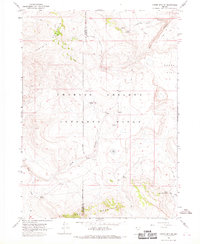
1966 Map of Catnip Mtn. SE
USGS Topo · Published 1969About this map
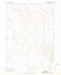
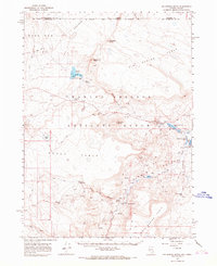
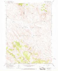
The Charles Sheldon Antelope Range dominates this mid-1960s landscape, illustrating a specialized conservation environment spanning the Washoe and Humboldt County border. This high-desert terrain is characterized by its vital water sources, including Fish Springs, Gooch Spring, and North Hell Creek Spring, which supported wildlife and early range management efforts. The topography is defined by prominent elevations such as Catnip Mountain and the flat-topped Gooch Table, while drainage systems like Echo Canyon and Horse Canyon Spring carve through the volcanic plateau. A network of Jeep Trails and the Patrol Trail crisscross the area, marking the movement of rangers and hunters through the Great Basin high country before modern paved access reached these remote stretches of northwestern Nevada.
Find a feature on this map
18 named features on this map. Tap any name to fly to it.
Don’t see what you’re looking for? This feature index may not catch every label — zoom into the map to look around manually.
Map Details
Editions of this 1966 Catnip Mtn. SE Map
This is the sole edition of this map. No revisions or reprints were ever made.
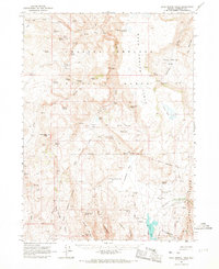
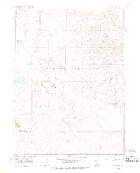
Other maps of this area

1889 · Long Valley
USGS Topo · 1:250,000

1954 · Vya
USGS Topo · 1:250,000

1958 · Vya
USGS Topo · 1:250,000

1962 · Vya
USGS Topo · 1:250,000
1965 · Rock Spring Table
USGS Topo · 1:62,500
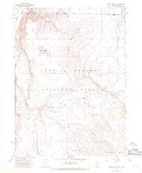
1966 · Catnip Canyon
USGS Topo · 1:24,000
1966 · Swan Lake
USGS Topo · 1:24,000
1966 · Badger Mtn NW
USGS Topo · 1:24,000
1966 · Big Spring Butte
USGS Topo · 1:62,500
1966 · Blowout Mtn
USGS Topo · 1:24,000