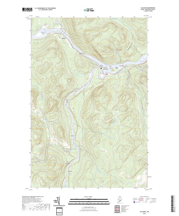
2024 Map of Allagash
USGS Topo · Published 2024About this map
The confluence of the Little Black River and the Saint John River at Dickey defines this northern Maine landscape, where the Upper Saint John River Valley transitions into the protected corridor of the Allagash Wild and Scenic River. This survey captures the remote character of Aroostook County, documenting the river-based geography of islands and gravel bars such as Three Mile Island, Wolf Island, and Ghost Landing Bar. Local history is anchored by the Allagash Municipal Cem and Saint Paul Catholic Cem, while the network of unpaved tracks like Michaud Tote Rd and Frank Mack Rd suggests the area's long-standing connection to the timber industry. The rivers are the primary landmarks, marked by technical challenges for navigators like Casey Rapids and Twin Brook Rapids.
Find a feature on this map
39 named features on this map. Tap any name to fly to it.
Don’t see what you’re looking for? This feature index may not catch every label — zoom into the map to look around manually.
Map Details
Editions of this 2024 Allagash Map
This is the sole edition of this map. No revisions or reprints were ever made.
Other maps of this area

1930 · Allagash
USGS Topo · 1:48,000

1930 · St Francis
USGS Topo · 1:48,000

1931 · Fish River Lake
USGS Topo · 1:48,000

1932 · Allagash Falls
USGS Topo · 1:48,000

1933 · Allagash
USGS Topo · 1:62,500

1933 · St Francis
USGS Topo · 1:62,500

1935 · Fish River Lake
USGS Topo · 1:62,500

1935 · Allagash Falls
USGS Topo · 1:62,500

1954 · Presque Isle
USGS Topo · 1:250,000

1956 · Allagash Falls
USGS Topo · 1:50,000