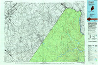
1993 Map of Allagash
USGS Topo · Published 1994About this map
The international border between Maine and Quebec defines this landscape, tracing the St Francis River and the winding course of the St John River. In Aroostook County, the settlement of Allagash serves as a gateway to the Allagash State Wilderness Waterway, while smaller hamlets like Dickey and Landry anchor the riverfront. The terrain transitions from the elevations of the Monts Notre Dame in Canada to the timbered ridges of Boat Landing Mountain and Johnson Brook Mountain in the United States.
Find a feature on this map
36 named features on this map. Tap any name to fly to it.
Don’t see what you’re looking for? This feature index may not catch every label — zoom into the map to look around manually.
Map Details
Editions of this 1993 Allagash Map
This is the sole edition of this map. No revisions or reprints were ever made.
Other maps of this area

1930 · Allagash
USGS Topo · 1:48,000

1930 · St Francis
USGS Topo · 1:48,000

1931 · Fish River Lake
USGS Topo · 1:48,000

1932 · Allagash Falls
USGS Topo · 1:48,000

1933 · Allagash
USGS Topo · 1:62,500

1933 · St Francis
USGS Topo · 1:62,500

1935 · Fish River Lake
USGS Topo · 1:62,500

1935 · Allagash Falls
USGS Topo · 1:62,500

1954 · Presque Isle
USGS Topo · 1:250,000

1955 · Rocky Mountain
USGS Topo · 1:62,500