
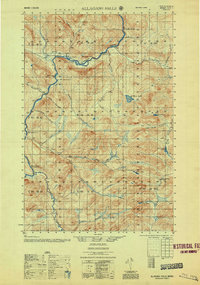
1956 Map of Allagash Falls
USGS Topo · Published 1956About this map
Allagash Falls serves as the central landmark for this section of the Maine North Woods, where the Allagash River cuts through a landscape defined by timber harvesting and river transport. During the mid-twentieth century, this remote region was anchored by seasonal outposts and logistical nodes such as Cunliffe Depot Camp and McKeen Camp. The map documents the scattered network of river-based operations, including Michaud Farm and Moores Farm, which supported the logging crews and travelers moving along the water.
Find a feature on this map
42 named features on this map. Tap any name to fly to it.
Don’t see what you’re looking for? This feature index may not catch every label — zoom into the map to look around manually.
Map Details
Editions of this 1956 Allagash Falls Map
2 editions found
Other maps of this area

1930 · Allagash
USGS Topo · 1:48,000

1930 · St Francis
USGS Topo · 1:48,000

1931 · Fish River Lake
USGS Topo · 1:48,000

1931 · Mooseleuk Lake
USGS Topo · 1:48,000

1932 · Umsaskis Lake
USGS Topo · 1:48,000

1932 · Musquacook Lakes
USGS Topo · 1:48,000

1932 · Allagash Falls
USGS Topo · 1:48,000

1933 · Allagash
USGS Topo · 1:62,500

1933 · St Francis
USGS Topo · 1:62,500

1935 · Umsaskis Lake
USGS Topo · 1:62,500