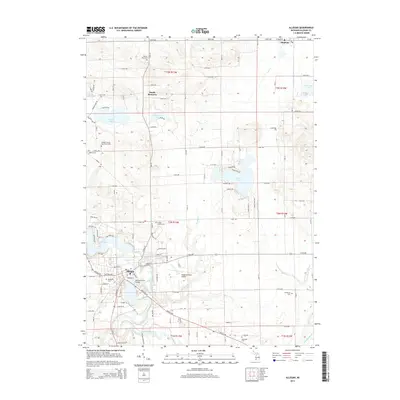
2014 Map of Allegan
USGS Topo · Published 2014About this map
The Kalamazoo River winds through the heart of Allegan, serving as a focal point for this Southwest Michigan community. In this 2014 survey, the town's connection to the water is evidenced by landmarks such as the Second Street Bridge and the expanse of Lake Allegan to the west. The landscape transitions from the developed streets of the county seat to the agricultural and wooded surroundings of South Monterey and Hopkins to the north.
Find a feature on this map
78 named features on this map. Tap any name to fly to it.
Don’t see what you’re looking for? This feature index may not catch every label — zoom into the map to look around manually.
Map Details
Editions of this 2014 Allegan Map
This is the sole edition of this map. No revisions or reprints were ever made.
Other maps of this area

1916 · Kalamazoo
USGS Topo · 1:62,500

1918 · Kalamazoo
USGS Topo · 1:62,500

1943 · Kalamazoo
USGS Topo · 1:62,500

1946 · Gobles
USGS Topo · 1:62,500

1948 · Gobles
USGS Topo · 1:62,500

1949 · Gobles
USGS Topo · 1:62,500

1958 · Allegan
USGS Topo · 1:62,500

1958 · Grand Rapids
USGS Topo · 1:250,000

1959 · Wayland
USGS Topo · 1:62,500

1961 · Grand Rapids
USGS Topo · 1:250,000