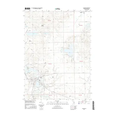
2017 Map of Allegan
USGS Topo · Published 2017About this map
Allegan sits at a strategic bend of the Kalamazoo River, where the historic Second Street Bridge spans the water near the heart of town. This 2017 study of the region reveals a landscape defined by its glacial history, with numerous water bodies like Miner Lake, Dumont Lake, and Wetmore Lake dotting the northern reaches. The map is particularly useful for genealogical research, documenting several local burial grounds including the Oakwood Cem and the Allegan County Poor Farm Cem. Outside the main settlement, rural hubs like South Monterey and Hopkins anchor the agricultural sections of the county. The terrain transitions from the developed grid of the county seat to the recreational shoreline of Lake Allegan and the aviation facilities at Padgham Field, providing a comprehensive view of modern land use in western Michigan.
Find a feature on this map
78 named features on this map. Tap any name to fly to it.
Don’t see what you’re looking for? This feature index may not catch every label — zoom into the map to look around manually.
Map Details
Editions of this 2017 Allegan Map
This is the sole edition of this map. No revisions or reprints were ever made.
Other maps of this area

1916 · Kalamazoo
USGS Topo · 1:62,500

1918 · Kalamazoo
USGS Topo · 1:62,500

1943 · Kalamazoo
USGS Topo · 1:62,500

1946 · Gobles
USGS Topo · 1:62,500

1948 · Gobles
USGS Topo · 1:62,500

1949 · Gobles
USGS Topo · 1:62,500

1958 · Allegan
USGS Topo · 1:62,500

1958 · Grand Rapids
USGS Topo · 1:250,000

1959 · Wayland
USGS Topo · 1:62,500

1961 · Grand Rapids
USGS Topo · 1:250,000