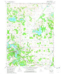
1981 Map of Allegan
USGS Topo · Published 1981About this map
The Kalamazoo River carves a winding path through the heart of the region, defining the landscape around the city of Allegan. By the late 1970s, the area's development reflects its role as a regional hub, featuring the County Fairground, General Hospital, and Padgham Field. The map reveals a transition from the structured street grids of Allegan to the surrounding agricultural townships of Monterey and Hopkins.
Find a feature on this map
62 named features on this map. Tap any name to fly to it.
Don’t see what you’re looking for? This feature index may not catch every label — zoom into the map to look around manually.
Map Details
Editions of this 1981 Allegan Map
This is the sole edition of this map. No revisions or reprints were ever made.
Other maps of this area

1916 · Kalamazoo
USGS Topo · 1:62,500

1918 · Kalamazoo
USGS Topo · 1:62,500

1943 · Kalamazoo
USGS Topo · 1:62,500

1946 · Gobles
USGS Topo · 1:62,500

1948 · Gobles
USGS Topo · 1:62,500

1949 · Gobles
USGS Topo · 1:62,500

1958 · Allegan
USGS Topo · 1:62,500

1958 · Grand Rapids
USGS Topo · 1:250,000

1959 · Wayland
USGS Topo · 1:62,500

1961 · Grand Rapids
USGS Topo · 1:250,000